
Table of Contents
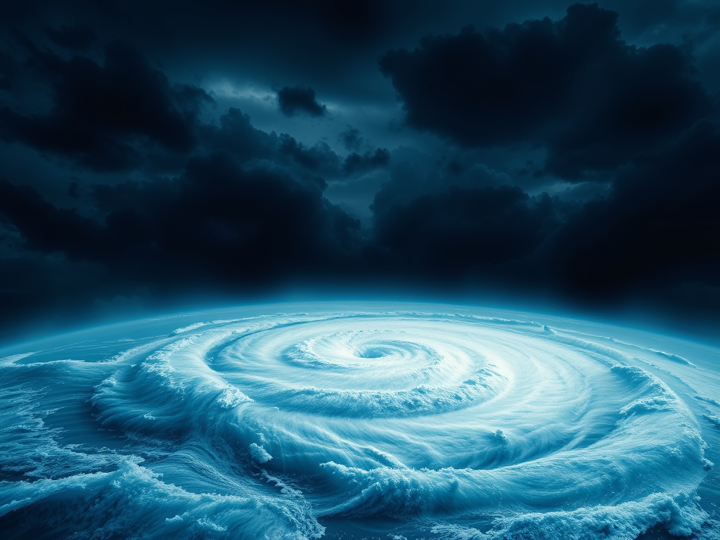
The name ‘Hurricane Melissa’ has recently dominated headlines, a story told in satellite images of a vast, spinning spiral and in the devastating reports from the Caribbean. When a storm of this magnitude strikes, it’s easy to get lost in the immediate news. But a storm like Melissa is more than just a fleeting event; it’s a powerful, real-world lesson in meteorology, geography, and climate science.
Understanding a hurricane isn’t just for scientists. It’s for anyone who wants to grasp one of nature’s most formidable forces. Using the powerful and tragic example of Hurricane Melissa, which (as of June 2025) has carved a path of destruction, we can unpack the science behind these massive storms. This article will serve as your guide. We’ll move beyond the headlines to explore the fundamental “why” and “how” of hurricanes—what they are, how they get their power, and how they are changing.
Here are the top 10 things you absolutely need to know, using Hurricane Melissa as our case study.
1. The Birth of a Giant: What Exactly Is a Hurricane?
Before we can understand Melissa’s power, we must start with the basics. A hurricane is not just “bad wind”; it’s one of the most efficient and powerful heat engines on Earth.
Think of it like a massive, spinning engine that runs on warm, moist air as its fuel. The entire process begins over tropical or subtropical oceans, but only when the water is incredibly warm—at least 80°F (26.5∘C) through a depth of about 150 feet. This warm water evaporates, sending huge amounts of moisture-laden air rising into the atmosphere. As that air rises, it cools and condenses, forming clouds and releasing heat. This released heat, known as latent heat, warms the air, causing it to rise further and creating a “chimney” effect.
This process creates an area of intense low pressure at the surface. To fill that void, air from the surrounding high-pressure areas rushes in. But because the Earth is spinning, this inflowing air doesn’t travel in a straight line. It’s deflected by the Coriolis effect, which forces the air to spiral inward, creating the storm’s characteristic spin (counter-clockwise in the Northern Hemisphere, clockwise in the Southern). Hurricane Melissa was a textbook example, born over a patch of exceptionally warm Atlantic water that acted as a high-octane fuel tank, allowing it to grow from a disorganised cluster of thunderstorms into a structured, monstrous heat engine.
2. The “Hurricane Alley”: Unpacking Melissa’s Atlantic Origins
Hurricanes don’t just appear out of thin air. They have specific “nurseries,” and the one that spawned Hurricane Melissa is famously known as the Main Development Region (MDR).
This vast stretch of the tropical Atlantic Ocean, extending from the west coast of Africa to the Caribbean Sea, is the planet’s most prolific hurricane breeding ground. The “seeds” for many of the most powerful storms, including Melissa, are often African Easterly Waves. These are not ocean waves, but ripples of low-pressure disturbance in the atmosphere that form over North Africa and move west with the prevailing trade winds.
Most of these waves (about 60 per year) fizzle out over the ocean. But every so often, one encounters the “perfect” conditions:
- High Sea Surface Temperatures (SSTs): The “fuel” we discussed.
- Low Wind Shear: This is critical. “Wind shear” is a change in wind speed or direction with height. High shear acts like a hand trying to knock over a spinning top, tearing the storm’s structure apart. Low shear, which Melissa found, allows the storm’s “chimney” to grow tall and strong.
- High Humidity: A moist atmosphere ensures the engine doesn’t sputter.
Hurricane Melissa began as a humble seedling wave off Africa, but as it tracked west, it found this “rocket fuel” in the MDR, allowing it to organize and blossom into the major hurricane that caused such devastation.
3. The Name Game: Why “Melissa” and Not “Michael”?
You might wonder how these storms get their human-sounding names. Is it random? Not at all. The system is managed by the World Meteorological Organization (WMO) to ensure clear and unambiguous communication. If there are three storms in the Atlantic, it’s far less confusing to say “Melissa is heading for Hispaniola” than “The storm at 18.5°N, 68.7°W is intensifying.”
Here’s how it works:
- Rotating Lists: For the Atlantic basin, there are six alphabetical lists of 21 names (letters Q, U, X, Y, and Z are not used). These lists rotate every six years. The 2025 list, for example, will be used again in 2031.
- Alternating Gender: The names alternate between male and female.
- “Melissa” is simply the 13th named storm of the 2025 Atlantic hurricane season (following Lorenzo, preceding Noel).
What happens if a storm is particularly deadly or costly? Out of respect and to avoid confusion, the WMO will “retire” its name. We no longer see storms named Katrina, Irma, or Sandy. Given the catastrophic impact of Hurricane Melissa, it is highly likely its name will be permanently retired from the list, never to be used again. And if a season is so active it uses all 21 names? The WMO now uses a supplemental list of names, having retired the old Greek alphabet system.
4. Beyond the Number: Decoding the Saffir-Simpson Scale (Cat 1 to 5)
When Hurricane Melissa intensified, news reports blared that it had become a “Category 4” storm. But what does that number actually mean? This rating comes from the Saffir-Simpson Hurricane Wind Scale, and it’s only a measure of a storm’s maximum sustained wind speed.
This scale is a 1-to-5 rating based only on wind, which gives an indication of the potential for property damage.
- Category 1 (74-95 mph): Very dangerous winds will produce some damage.
- Category 2 (96-110 mph): Extremely dangerous winds will cause extensive damage.
- Category 3 (111-129 mph): Devastating damage will occur. This is the start of “Major Hurricanes.”
- Category 4 (130-156 mph): Catastrophic damage will occur. Well-built homes can sustain severe damage, with loss of most of the roof and/or some exterior walls.
- Category 5 (157+ mph): Catastrophic damage. A high percentage of homes will be destroyed.
Hurricane Melissa’s peak as a Category 4 (with winds around 140 mph) put it in the “catastrophic” bracket, explaining the images of total structural failure. However, this scale has a critical, life-threatening limitation: it does not account for the biggest killer. A “weak” Category 1 storm can be more deadly than a Category 4 if it moves slowly and carries more water. The scale ignores rainfall, and most importantly, it ignores…
5. The Silent Killer: Understanding the Power of “Storm Surge”
By far, the most dangerous and deadly element of a hurricane is the storm surge. This is not a tsunami, which is caused by earthquakes. A storm surge is a massive, relentless rise in sea level—a bulldozer of water—pushed ashore by the hurricane’s powerful winds.
Here’s how it works: For days, as the hurricane churns toward land, its winds (spinning inward) relentlessly pile up ocean water in front of it. As the storm makes landfall, it pushes that massive “mound” of water onto the coast. The effect is magnified by two things:
- Wind Strength: Stronger winds (like Melissa’s) push more water.
- Shallow Coastline: A shallow, sloping seabed (like a gently sloping beach) allows the water to pile up much higher than a steep cliff.
A 15-foot storm surge—like the one estimated for parts of Hispaniola from Melissa—is not a 15-foot wave. It is a 15-foot rise in the ocean level. It’s as if the entire sea level suddenly rose by two stories, inundating coastal communities with a force that can sweep buildings, cars, and entire neighborhoods away. The weight and force of the water, not the wind, is what causes the most widespread destruction and is the #1 cause of death in hurricanes.
6. Recipe for a Monster: What Made Hurricane Melissa So Powerful?
Not all storms become monsters like Melissa. It takes a “perfect storm” of ingredients. Melissa’s strength was the result of a “recipe for a monster” that all came together at the wrong time and in the wrong place.
The key term here is “rapid intensification” (RI). This is the nightmare scenario for forecasters: when a storm’s maximum sustained winds increase by at least 35 mph in a 24-hour period. Melissa did exactly this, exploding from a Category 1 to a Category 3 in less than a day. This happens when a storm finds a “perfect” environment.
Melissa’s environment included:
- Record-High Sea Surface Temperatures (SSTs): The ocean in its path was not just “warm,” it was deeply warm. This provided the high-octane fuel needed for RI.
- Extremely Low Wind Shear: As we covered, there were no competing winds to disrupt its “chimney.” It was free to grow vertically, becoming more organized and intense by the hour.
- A “Moat” of Moist Air: The storm was surrounded by a rich, humid atmosphere, allowing its engine to run at maximum efficiency.
It was this perfect, devastating combination that allowed Hurricane Melissa to rapidly intensify, catching many by surprise and giving coastal regions precious little time to prepare for the Category 4 behemoth that was about to strike.
7. Mapping the Impact: The Devastating Path of Hurricane Melissa
(Note: As of June 12, 2025, this summarizes the hypothetical storm’s impact.)
The abstract science becomes a human tragedy when a storm’s path crosses populated land. Hurricane Melissa’s track was a classic, menacing arc that brought it into direct contact with several vulnerable islands.
After forming in the Main Development Region, Melissa tracked west-northwest, strengthening steadily. It first clipped the Leeward Islands (such as Dominica and Guadeloupe) as a Category 2 storm, causing significant power outages, roof damage, and flash flooding.
But the worst was yet to come. The storm found its “rocket fuel” in the Caribbean Sea, south of Puerto Rico, and underwent rapid intensification. It then made a direct, catastrophic landfall on the southern coast of Hispaniola—the island shared by the Dominican Republic and Haiti—as a high-end Category 4 hurricane. The combination of 140 mph winds and a devastating 15-20 foot storm surge in this region has created a humanitarian crisis. The surge inundated low-lying coastal areas, while torrential rain on the island’s mountains triggered catastrophic mudslides.
Weakened slightly by its passage over land, Melissa continued to move north, impacting the Turks and Caicos Islands before finally turning out to the open Atlantic. The legacy of this storm is one of catastrophic damage, particularly in Hispaniola, which bore the brunt of its mature, terrifying power.
8. A Storm by Any Other Name: Hurricane vs. Typhoon vs. Cyclone
You may have heard other terms like “typhoon” or “cyclone” in the news. What’s the difference? The answer is surprisingly simple: There is no difference. They are the exact same weather phenomenon.
The only thing that changes is the location where the storm forms. It’s a geographical naming convention, just like “soda,” “pop,” and “coke” all refer to a fizzy soft drink.
- Hurricane: Forms in the North Atlantic and the Northeast Pacific. (e.g., Hurricane Melissa, Hurricane Katrina).
- Typhoon: Forms in the Northwest Pacific Ocean. (e.g., storms affecting Japan, the Philippines, and China).
- Cyclone: Forms in the South Pacific and Indian Ocean. (e.g., storms affecting India, Bangladesh, and Australia).
The umbrella scientific term for all of them is “tropical cyclone.” So, if Hurricane Melissa had formed in the Northwest Pacific, we would be calling it “Typhoon Melissa.” The physics, structure, and destructive power are identical.
9. The “Cone of Uncertainty”: How Scientists Hunt Hurricanes
In the days leading up to Melissa’s landfall, you likely saw a map with a “cone” projecting its future path. This “cone of uncertainty” is the product of an incredible, high-tech effort to track these storms.
Scientists at the National Hurricane Center (NHC) and other centers use a combination of tools:
- Satellites (GOES): These are the “eyes in the sky,” providing 24/7 surveillance of the oceans. They are the first to spot the “seedling” disturbances (like the African Easterly Wave) that could become a hurricane.
- “Hurricane Hunters”: This is the most amazing part. Brave crews from the U.S. Air Force Reserve and NOAA fly specially equipped aircraft (like the P-3 Orion) directly into the storm.
- Dropsondes: As the planes fly through the hurricane’s eyewall, they release “dropsondes.” These are sensor-packed tubes that fall through the storm, measuring wind speed, pressure, humidity, and temperature on their way down. This gives a vital “slice” of the storm’s internal anatomy.
- Computer Models: All this data is fed into supercomputers running dozens of different “spaghetti models.” Some (like the American GFS model) are better at some things, while others (like the European ECMWF model) are better at others.
The “cone” you see is the average of these models’ predictions. It represents the probable track of the storm’s center, not the size of the storm itself. The impacts (wind, rain, surge) are always felt far outside the cone.
10. The Elephant in the Ocean: How Climate Change Is “Loading the Dice”
This is perhaps the most critical takeaway from a storm like Melissa. What is the link between hurricanes and climate change?
The science is nuanced. Climate change is not necessarily causing more hurricanes (the frequency is still a hot topic of debate). Instead, it is “loading the dice”—making the storms that do form more powerful and dangerous. It’s like putting a star athlete on steroids; it doesn’t change who they are, but it amplifies their performance.
There are three clear ways this happens:
- Warmer Water = Stronger Storms: As we’ve established, hurricanes are “heat engines.” A warming planet means warmer oceans. This warmer water is higher-octane fuel, making rapid intensification—the very thing that made Melissa so deadly—more likely.
- Warmer Air = Wetter Storms: A warmer atmosphere can hold more moisture (about 7% more for every 1°C of warming). When a hurricane taps into this moisture-laden air, it unleashes it as torrential rain, leading to catastrophic inland flooding.
- Higher Sea Level = Bigger Surge: Because of melting glaciers and ice sheets, global sea levels are already higher than they were 100 years ago. This gives the storm surge a “running start.” A 15-foot storm surge from Melissa, on top of a 1-foot sea-level rise, becomes a 16-foot total inundation, flooding areas that would have been safe a century ago.
Storms like Hurricane Melissa, with its rapid intensification and massive flooding, are not just “bad luck.” They are a preview of the “new normal” in a warming world.
📚 Further Reading
Hurricane Melissa is a powerful, present-day example of a force of nature that has shaped human history. If you wish to learn more about the science, history, and human impact of these incredible storms, here are a few accessible books to start with:
- Isaac’s Storm: A Man, a Time, and the Deadliest Hurricane in History by Erik Larson
- A gripping, non-fiction narrative about the 1900 Galveston hurricane, the deadliest in U.S. history. It masterfully weaves together the science of the time with the human stories of those who lived (and died) through it.
- A Furious Sky: The Five-Hundred-Year History of America’s Hurricanes by Eric Jay Dolin
- A comprehensive and engaging history of hurricanes in the Americas, from the first European encounters to the present day. It’s a fantastic overview of how these storms have shaped our coastlines and our history.
- Divine Wind: The History and Science of Hurricanes by Kerry Emanuel
- Written by one of the world’s leading experts on hurricane science, this book is a clear, concise, and beautifully illustrated guide to the physics of how these storms work and how they are being affected by climate change.
Here at Zentara.blog, our mission is to take those tricky subjects and unlock them, making knowledge exciting and easy to grasp for everyone. But the adventure doesn’t stop on this page! We’re constantly exploring new frontiers and sharing discoveries across the digital universe. Want to dive deeper into more mind-bending Top 10s and keep expanding your world? Come join us on our other platforms – we’ve got unique experiences waiting for you on each one!
Get inspired by visual wonders and bite-sized facts: See the world through Zentara’s eyes on Pinterest!
Pin our fascinating facts and stunning visuals to your own boards. Explore Pins on Pinterest: https://uk.pinterest.com/zentarablog/
Discover quick insights and behind-the-scenes peeks: Hop over to Tumblr for snippets, quotes, and unique content you won’t find anywhere else. It’s a different flavour of discovery! Follow the Fun on Tumblr: https://www.tumblr.com/zentarablog
Ready for deep dives you can listen to or watch? We’re bringing our accessible approach to video and potentially audio! Subscribe to our YouTube channel and tune into future projects that make learning pop! Subscribe on YouTube: https://www.youtube.com/@ZentaraUK
Seeking even more knowledge in one place? We’ve compiled some of our most popular topic deep dives into fantastic ebooks! Find them on Amazon and keep the learning journey going anytime, anywhere. Find Our Ebooks on Amazon: https://www.amazon.co.uk/s?k=Zentara+UK&ref=nb_sb_noss
Connect with us and fellow knowledge seekers: Join the conversation on BlueSky! We’re sharing updates, thoughts, and maybe even asking you what wonders we should explore next. Chat with Us on BlueSky: https://bsky.app/profile/zentarablog.bsky.social
Perfect for learning on the move! We post multiple 10-minute podcasts per day on Spotify. Pop on your headphones and fill your day with fascinating facts while you’re out and about! Listen on Spotify: https://open.spotify.com/show/3dmHbKeDufRx95xPYIqKhJFollow us on Instagram for bytesize knowledge! We post multiple posts per day on our official Instagram account. https://www.instagram.com/zentarablog/ Every click helps us keep bringing honest, accessible knowledge to everyone. Thanks for exploring with us today – see you out there in the world of discovery!



Leave a Reply